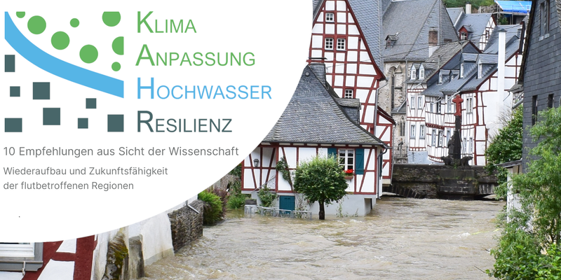
The flood disaster in North Rhine-Westphalia and Rhineland-Palatinate last year is one of the most serious flood events in Germany of the last decades. It left the affected communities and regions not only with immense damage, but also with numerous questions about reconstruction and future prevention. The research project KAHR, funded by the German Federal Ministry of Education and Research (BMBF), aims to help with these strategic challenges. KAHR stands for Climate Adaptation, Flood and Resilience (KlimaAnpassung, Hochwasser und Resilienz) and aims to provide scientific support and advice for the reconstruction process. What could be the starting points for a climate-adapted and thus resilient development of the regions? - this is the central question.
At a first science conference in June, researchers from various disciplines developed ten recommendations around the topic of reconstruction and sustainability of flood-affected regions. The specific topics ranged from spatial risk management and flood preparedness to critical infrastructure protection, flood hydrology, and the various actors involved in reconstruction, highlighting the need for action at various administrative and policy levels for reconstruction, regional development and climate adaptation. Now, KAHR researchers published these ten recommendations in a preganted version and besides the spokespersons of the KAHR joint project Prof. Dr. Jörn Birkmann and Prof. Dr. Holger Schüttrumpf, numerous other scientists joined, including emergenCITY scientist Nadja Thiessen.
“The demands are a strong concern to me and I would like to fully support them,” says Thiessen, who conducts research on learnings from past disasters and the use of historical empirical knowledge for crisis management at emergenCITY. From the perspective of historical disaster research, she claims the 6th recommendation as particularly important. It calls for strengthening the signalling function of plans and, in this context, for making heavy rain hazard and risk maps publicly accessible. After all, in an ongoing survey of affected households in the district of Ahrweiler, 70% of respondents stated that they had not known before last year’s flood that their home was situated in an area exposed to flooding (cf. KAHR Recommendation 6) KAHR scientists therefore recommend:
“Separate representation of affected areas in the event of an extreme historical flood should be considered. In addition, the spread of flooding during past events should also be indicated by flood marks in the terrain, on buildings and along infrastructures in order to continuously maintain risk awareness.” (translated quote from KAHR Recommendation 6)
For Thiessen, this knowledge of and about past flood events is of central importance: “The establishment of a flood memory culture in everyday life will help to strengthen risk awareness among the population and decision-makers. This will also make necessary spatial planning measures more comprehensible and increase sensitivity to warnings,” says the historian. According to Thiessen, it is important to use such knowledge to plan protection strategies for the future and to avoid being surprised by such extreme events to the same extent (cf. KAHR Recommendation 2) and to take it into account for flood prevention in spatial planning (cf. KAHR Recommendation 7).


