Mission Digital Heinerblock
Resilience of digital cities needs to be investigated as the interplay of technology with social and societal aspects, as well as spatial indicators with special attention to historical knowledge. The mission Digital Heinerblock studies aspects of this relation on district level and investigates them by example of the 10ha large Lichtenbergblock in Darmstadt’s Martinsviertel. There, we closely work together with the Wissenschaftsstadt Darmstadt, who launched a process of urban transformation there. We investigate this path that aims to establish districts with sustainable concepts for traffic, improved climate resilience and a livable approach to urban space usage. Furthermore, the district serves as our living lab for transfer of solutions proposed by emergenCITY and their real-world evaluation.
Contact Us
We define our mission based on three overlapping areas:
Communication and Interaction with Citizens
Sustainable, inclusive and integrated urban design plays a decisive role in the transformation towards resilient city districts. That also includes the participation of citizens in a co-creative process, which creates acceptance and improves social resilience. We investigate which forms of communication are particularly suitable for creating awareness for crises among citizens, which forms are acceptable during crises, and how urban areas can be designed to inherently provide support during crises.
A project in this area is the further development of our
Another example for the communication with citizens in crises is our smart advertising pillar
But communication with citizens does not stop here.
Analysis of Urban Data
Data about cities exists in a variety of formats, time scales, and spatial resolutions. Cutting-edge digital methods for data gathering and processing improve our ability to analyze complex, interdependent urban processes. One goal of the mission is to explore the new plenitude of data to identify data types and sources which can help to anticipate or overcome crises. As the resources for data gathering and processing are limited during crises, focusing on and selecting the data that matters is crucial.
To address this goal, we research
Resilient Communication Infrastructure
Transfer of real-time information from the city as well as forwarding warning messages to the citizens requires a resilient communication infrastructure. Communication networks and data centers are particularly vulnerable to crises, as they can suffer from direct physical damage, but also depend on other infrastructure like the power grid. Their structure is also prone to complex, cascading outages. We therefore investigate the question how the urban communication infrastructure needs to be designed in order to support citizens and first responders in different crisis scenarios.
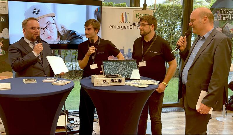
In a cooperation with the city of Darmstadt, we install a productive
Research Question
Which modes of communication are suitable to create awareness and foster preparation for crises? How can we design cities which support their citizens in crises? Which data can help improving the resilience in the district? How can urban communication infrastructure adapt during crises, to serve citizens and first responders?
Program Areas in the Mission

City and Society (SG)
The program area SG will focus on the question of awareness aiming to assess the state of preparedness of the population. Emphasis lies on events related to climate change such as summer heat waves and heavy storms. Innovative methods such as gamification and the integration of historical knowledge are applied in order to develop a guideline for the integrative and inclusive transformation to climate-adaptive cities.
Team: Felipe Francisco De Souza Hans-Joachim Linke Joachim Schulze Annette Rudolph-Cleff Nadja Thiessen Jens Ivo Engels
Communication (KOM)
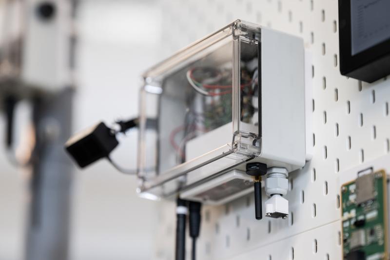
The program area KOM monitors the Lichtenbergviertel’s transformation with a network of sensor boxes, which can measure temperature, air humidity, particulate matter, noise, and usage of urban space. The collected data will be made public for interested citizens. Beyond measuring, the sensor boxes provide a wireless testbed for evaluating novel communication protocols and concepts for functional morphing in the field. To achieve that, the boxes are equipped with hardware for communication technologies like WiFi, Bluetooth, and LoRa.
Team: Frank Hessel Matthias Hollick Julian Euler Vincenz Mechler Ladan Khaloopour Mohamadreza Delbari Christian Eckrich Vahid Jamali
Information (INF)
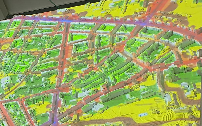
The program area INF investigates new, interactive data processing approaches in the Digital Heinerblock. Modern options for interaction and visualization can foster planning and evaluating measures to improve city climate and crisis response. An interactive city model, for example, can allow all decision makers, independently of their domain expertise, to apprehend complex data about the city, including historical data. This simplifies the collaboration between different actors and informing the population significantly.


